Stage 5 · Working map
The Map
Where the fighting was, day by day. Drag the scrubber and the map follows the battle in — two hundred kilometres of front on 16 April, a few hundred metres of government quarter by 30 April.
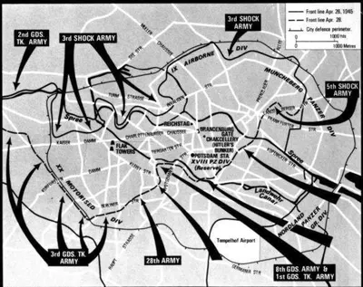
The Soviet plan of attack on the centre of Berlin - April 1945 rights unverified
56 places plotted from the day-by-day account, and the shape of the operation around them. Every line on this map carries the kind of claim it is making.
- Schematic
- The shape of the operation, drawn through places this account already locates. Which front came from where is not in dispute; the line between two waypoints is a reading aid, not a trace of where anyone stood.
- Derived
- Computed from the writing itself — the ground the day’s article covers. It says what was written about, not where the front line ran.
- Traced
- A front line read off a named published sheet and georeferenced, with a confidence stated per segment. There are none yet — 0 of them. An empty layer is an honest answer; an invented polyline is not.
Modern base map © OpenStreetMap contributors, desaturated for legibility against the plotted layers. 1953 aerial imagery: Geoportal Berlin, Luftbilder 1953, Maßstab 1:22 000, Senatsverwaltung für Stadtentwicklung, Bauen und Wohnen — published without access restrictions.
There is no 1945 layer. Berlin’s surviving aerial surveys skip the war years, and 1953 is the closest available — eight years after the battle, with the Tiergarten still stripped bare and the government quarter still in rubble. Wartime Allied reconnaissance photography exists at the US National Archives but is not served as tiles by anyone; georeferencing it is Stage 5 proper.
All places
50 of 56 plotted places carry an era photograph. The rest have none that cleared the rights bar, and are marked so rather than filled with a modern view.
Reading the ground
The sheets
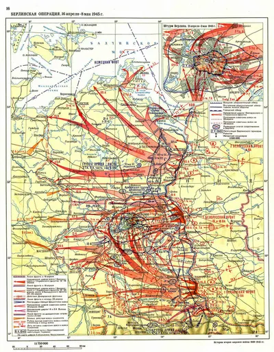
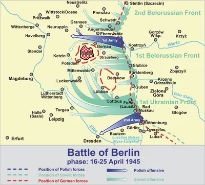
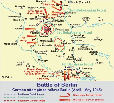
16 maps and plans, in the order that builds the picture: the country the offensive crossed, then the city and how it was organised to be held, then the few hundred metres it came down to. Each one links to its full catalogue record, with the repository’s own rights statement.
11 of these 16 were drawn afterwards — mostly by Wikimedia contributors between 2006 and 2025 — to explain the battle rather than to fight it. They are secondary sources and each one is marked drawn later. A sheet marked period was made at the time or directly from a wartime original.
The approach
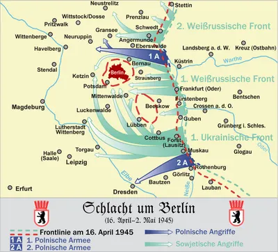
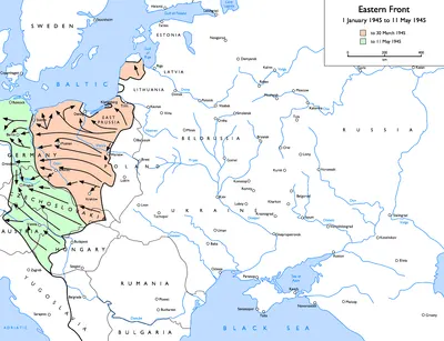
Two hundred kilometres of front, from the Oder bridgehead at Küstrin and the Neisse in the south, closing on one city. These are the sheets that show why the fighting reached Berlin from the east and the south-east and not from anywhere else.
The city, and how it was held
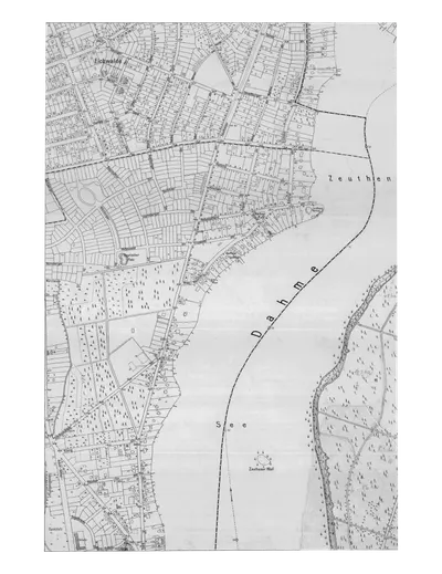
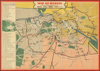
Berlin as it was laid out before it was fought over, and the defensive scheme imposed on that layout: the outer ring, the S-Bahn ring, and the eight lettered sectors with the government quarter as sector Z, the Zitadelle.

The last few hundred metres
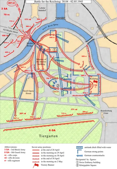
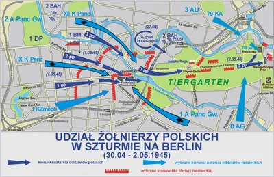
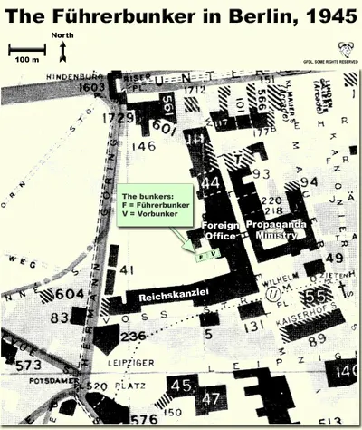
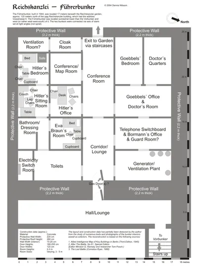
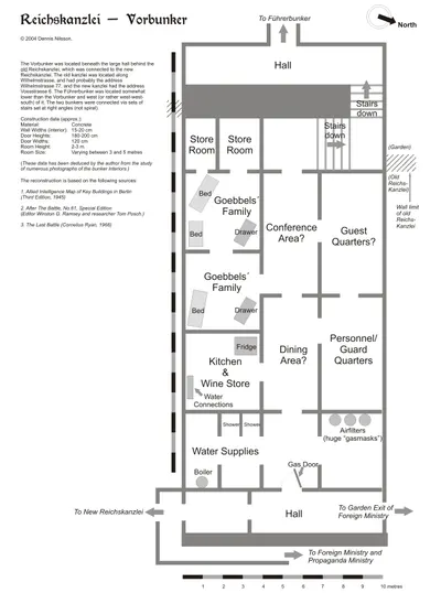
From the Moltke Bridge to the Reichstag is six hundred metres and it took two days. These are the sheets of the government quarter — the assault on the Reichstag, the Chancellery, and the bunker under its garden.
What followed
The city the battle left, divided four ways within eight weeks of the surrender. Included because the sector boundaries drawn on these sheets are the reason so much of the ground in this account is described in terms that did not exist in April 1945.
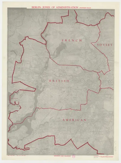

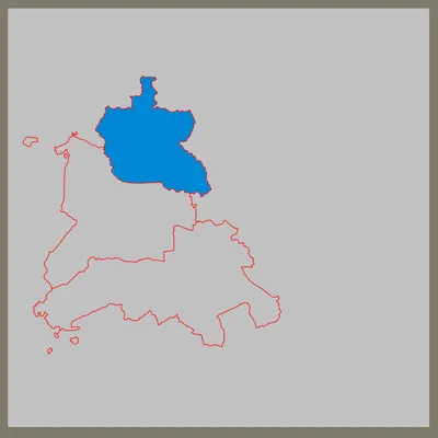
93 sheets are catalogued in all, 93 of them cleared for reuse. 77 cleared sheets are not grouped above — they are catalogued and searchable, but they do not help explain the layout. Every catalogued sheet →
Not held
- A German defence-sector sheet — Weidling's A to H and the Zitadelle. The nine sectors are in the entity model as places, three of them with no coordinate because no source consulted locates them, and a single staff sheet would settle all three. The 1945 Soviet map above is the closest thing held: it shows the city the assault was planned on, but not the German command scheme imposed on it.
- A dated Soviet situation map for any single day of the battle. The catalogue holds operation-level sheets covering the whole seventeen days and nothing that shows one morning, which is why no front line on the map above is traced.
- A 1943–45 Berlin street plan at a scale that reads at screen size. The Pharus commercial plans are the right document; the copies held are either postwar or too coarse to georeference.
- Allied reconnaissance photography of Berlin from April 1945. It exists at the US National Archives and is not served as tiles by anyone, which is the whole reason the map's historic layer is 1953 and not 1945.
- Most of the sheets here are still modern cartography, and the period ones that have arrived are city plans rather than operational maps. Anything drawn in April 1945 by someone who was reading it under fire outranks all of it.