Occupied Berlin
Map Wikimedia Commons 2006-06-19 13:40 CC BY-SA Modern
Modern. This was made after the war. It is a modern work about the battle, not a document of it.Published on Wikimedia Commons as the uploader's own work, so it is a modern work about 1945 — a drawn diagram, or a photograph of something that survives — rather than a document made at the time.
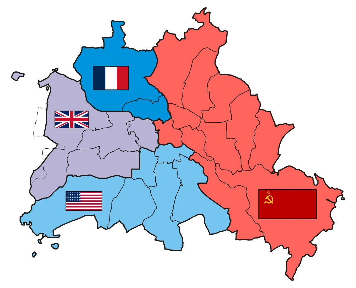
The four sectors of the occupied Berlin
Rights
CC BY-SA 3.0
as published by Wikimedia Commons · http://creativecommons.org/licenses/by-sa/3.0/
The repository publishes this item as CC BY-SA, crediting Stefan-Xp. Share-alike: attribution is obligatory and derivative works must carry the same licence. See docs/sustainability.md — this constrains the site’s own content licence.
Attribution line
Stefan-Xp · Occupied Berlin · Wikimedia Commons · CC BY-SA
Share-alike. Reuse obliges you to credit as above and to license any derivative work under the same terms.
- Held by
- Wikimedia Commons
- Creator
- Stefan-Xp
- Date as recorded
- 2006-06-19 13:40
- Medium
- Map
- Depicts
- Modern
- Hosting
- hosted
- Master
- 2480 × 2008 · 0.1 MB
- Catalogued
- 2026-09-21
GFDLImages with annotationsLicense migration completedSelf-published work1945 in BerlinSVG maps of BerlinFiles with derivative versionsStefan-Xps GraphicsInvalid SVG created with CorelDRAW:MapsCommunist symbols
