Eastern Front 1945-01 to 1945-05
Map Wikimedia Commons 2016-10-04 19:00:05 CC BY-SA Modern
Modern. This was made after the war. It is a modern work about the battle, not a document of it.A modern cartographer's diagram of the Eastern Front between January and May 1945, drawn for Wikimedia rather than at the time. It is a secondary source and a good one; it is not a sheet anyone used.
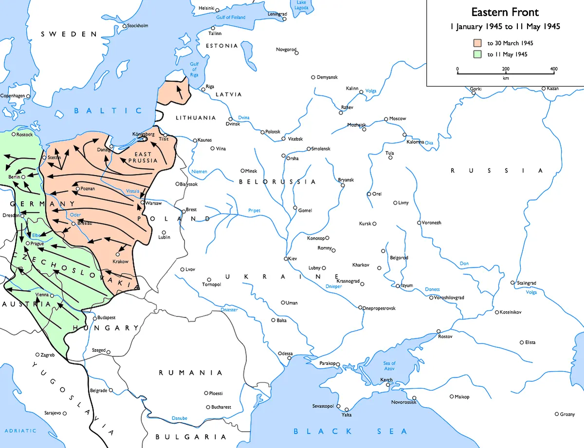
Map of the Eastern Front (WWII) , 1945-01-01 to 1945-05-07
Rights
CC BY-SA 3.0
as published by Wikimedia Commons · http://creativecommons.org/licenses/by-sa/3.0/
The repository publishes this item as CC BY-SA, crediting Gdr , Wikipedia (EN) user. Share-alike: attribution is obligatory and derivative works must carry the same licence. See docs/sustainability.md — this constrains the site’s own content licence.
Attribution line
Gdr , Wikipedia (EN) user · Eastern Front 1945-01 to 1945-05 · Wikimedia Commons · CC BY-SA
Share-alike. Reuse obliges you to credit as above and to license any derivative work under the same terms.
- Held by
- Wikimedia Commons
- Creator
- Gdr , Wikipedia (EN) user
- Date as recorded
- 2016-10-04 19:00:05
- Medium
- Map
- Depicts
- Modern
- Hosting
- hosted
- Master
- 1201 × 921 · 0.2 MB
- Catalogued
- 2026-09-21
Vistula–Oder OffensiveLower Silesian OffensiveGFDLUpper Silesian OffensiveEast Pomeranian OffensiveLicense migration completedHistorical map images that should use vector graphicsPNG that should use vector graphicsMaps of the Eastern Front in World War II
