Target Berlin (1943)
Map Wikimedia Commons 1943-10-25 Public domain Map sheet
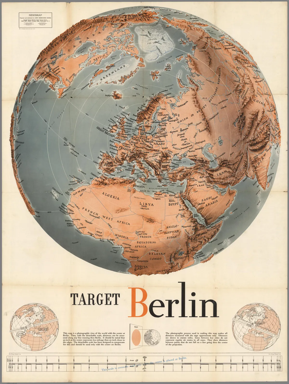
Shaded relief map centered on Berlin, Germany. Has a cut-away scale for measuring distances from Berlin or, alternatively one can use the concentric rings. Some flight routes and mileages shown. Hemispherical view.
Rights
Public domain
as published by Wikimedia Commons
The repository publishes this item as Public domain, crediting Army Orientation Course. Public domain per the item’s own record.
Attribution line
Army Orientation Course · Target Berlin (1943) · Wikimedia Commons · Public domain
- Held by
- Wikimedia Commons
- Creator
- Army Orientation Course
- Date as recorded
- 1943-10-25
- Medium
- Map
- Depicts
- Map sheet
- Hosting
- hosted
- Master
- 4020 × 5343 · 4.2 MB
- Catalogued
- 2026-09-21
PD US MilitaryMaps of the world during World War II1943 maps of the worldOld hemisphere world maps (partner files)Old maps of Earth's hemispheres – orthographic
