Reuterkiez Rixdorf Neukölln Berlin 1827
Map Wikimedia Commons 1827 Public domain Map sheet
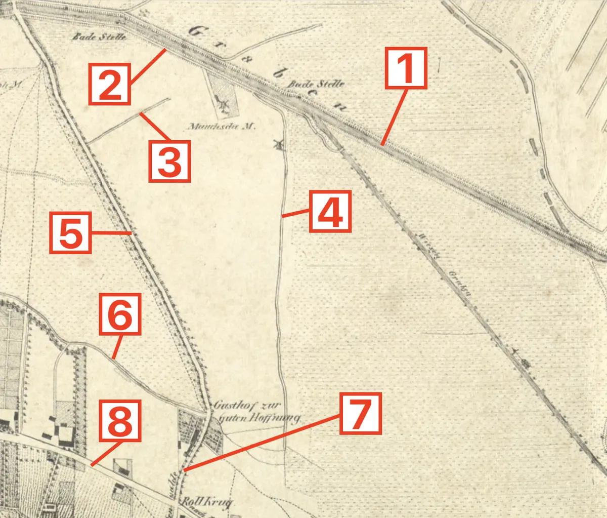
Historical map of modern-day Reuterkiez (Rixdorf, today Neukölln, Berlin), ca. 1827, with modern-day locations: [1] Landwehrkanal, [2] Maybachufer, [3] Schinkestraße/Bürknerstraße (approximate), [4] Friedelstraße, [5] Kottbusser Damm, [6] Urbanstraße, [7] Hermannplatz, [8] Hasenheide
Rights
Public domain
as published by Wikimedia Commons
The repository publishes this item as Public domain, crediting unknown/unattributed; published by: Königlicher Preußischer Großer Generalstab, Topographische Abteilung (1827). Public domain per the item’s own record.
Attribution line
unknown/unattributed; published by: Königlicher Preußischer Großer Generalstab, Topographische Abteilung (1827) · Reuterkiez Rixdorf Neukölln Berlin 1827 · Wikimedia Commons · Public domain
- Held by
- Wikimedia Commons
- Creator
- unknown/unattributed; published by: Königlicher Preußischer Großer Generalstab, Topographische Abteilung (1827)
- Date as recorded
- 1827
- Medium
- Map
- Depicts
- Map sheet
- Hosting
- hosted
- Master
- 1738 × 1482 · 3.5 MB
- Catalogued
- 2026-09-21
Maps of Berlin-NeuköllnNeuköllnPD US expiredPD-anon-70-EUPD-Germany-§1341820s maps of BerlinPD-US missing SDC copyright statusDetails of old maps of BerlinDetails of old maps, defaced with numbers
