Newsmap - Potsdam briefs
Map Wikimedia Commons 1945-08-13 Public domain Map sheet
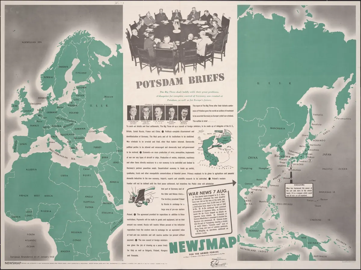
Summary of Potsdam conference. Map shows European boundaries as of January 1938. Inset map details administration of eastern Germany and East Prussia.
Rights
Public domain
as published by Wikimedia Commons
The repository publishes this item as Public domain, crediting Army Information Branch. Public domain per the item’s own record.
Attribution line
Army Information Branch · Newsmap - Potsdam briefs · Wikimedia Commons · Public domain
- Held by
- Wikimedia Commons
- Creator
- Army Information Branch
- Date as recorded
- 1945-08-13
- Medium
- Map
- Depicts
- Map sheet
- Hosting
- hosted
- Master
- 2578 × 1928 · 1.2 MB
- Catalogued
- 2026-09-21
PD US MilitaryAftermath of World War IIPotsdam ConferenceNewsmaps1945 maps of the world
