Map of northern Labuan marked with estimated Japanese positions and Allied invasion beaches as of April 1945
Map Wikimedia Commons 1945-04 Public domain Map sheet
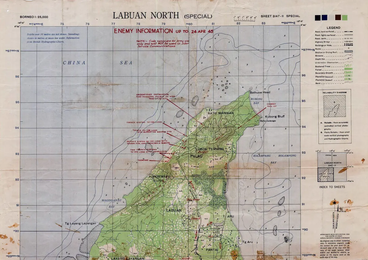
An Allied map of the northern portion of Labuan Island in modern Malaysia, marked with the positions which Allied intelligence believed that the island's Japanese garrison was occupying as at April 1945
Rights
Public domain
as published by Wikimedia Commons
The repository publishes this item as Public domain, crediting The map is marked as being the work of the 2/1 Australian Army Topographic Survey Company, and being issued under the authority of the General Staff Officer 1 of the Australian Army's I Corps. Public domain per the item’s own record.
Attribution line
The map is marked as being the work of the 2/1 Australian Army Topographic Survey Company, and being issued under the authority of the General Staff Officer 1 of the Australian Army's I Corps · Map of northern Labuan marked with estimated Japanese positions and Allied invasion beaches as of April 1945 · Wikimedia Commons · Public domain
- Held by
- Wikimedia Commons
- Creator
- The map is marked as being the work of the 2/1 Australian Army Topographic Survey Company, and being issued under the authority of the General Staff Officer 1 of the Australian Army's I Corps
- Date as recorded
- 1945-04
- Medium
- Map
- Depicts
- Map sheet
- Hosting
- hosted
- Master
- 1979 × 1400 · 1.1 MB
- Catalogued
- 2026-09-21
Battle of LabuanMaps of LabuanPD-AustraliaPD-1996Maps of World War II in the PacificMaps of the history of Malaysia
